
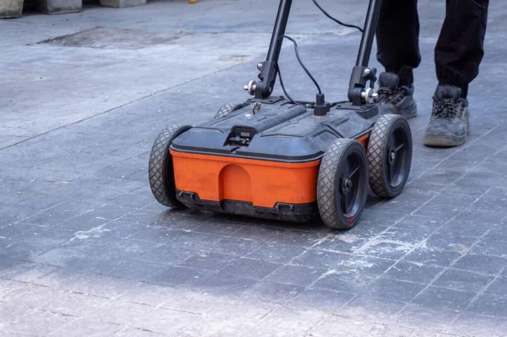
Ground penetrating radar (GPR) is the safest and most reliable method for detecting underground utilities before excavation. It helps avoid utility strikes, reduce project delays, and improve worker safety by delivering accurate, real-time data beneath the surface. This guide highlights the Top 5 GPR systems of 2026, trusted by utility locators, construction crews, engineers, and municipal teams to keep projects moving safely and efficiently.
According to the Common Ground Alliance, utility strikes cost the U.S. construction sector over $30 billion per year in damages, delays, and safety risks. That cost is avoidable, and GPR is how the industry avoids it.
Whether you’re scanning a slab or mapping buried services across a job site, confidence comes from data you can trust. These GPR systems are field-tested, results-driven, and built to perform under pressure.
For 25 years, Kleinschmidt Surveying has been a trusted supplier of advanced surveying and subsurface detection equipment, delivering the same high standards expected from world-class partners like Trimble, Leica, Topcon, FLIR, and GSSI.
What Is a Ground Penetrating Radar System?
A ground penetrating radar system is a non-destructive tool that uses electromagnetic energy to scan underground. This type of radar sends high-frequency signals into the ground, and those signals reflect off buried objects or material changes. The system then turns those reflections into images for the operator to review on-screen.
These systems are used to detect a wide range of buried objects and materials. Depending on the frequency of the antenna and the soil type, GPR can detect:
- Metallic and non-metallic utilities
- Concrete reinforcements such as rebar or post-tension cables
- Plastic pipes, empty ducts, and buried tanks
- Voids, air pockets, and soil disturbances
- Changes in soil type or compaction
Ground-penetrating radar systems are widely used across the construction, engineering, and infrastructure industries. They’re also part of many site inspection tools used by private contractors and government agencies. Surveyors often rely on GPR to locate old services before design or construction starts.

GPR vs Electromagnetic Locators
Both GPR and electromagnetic (EM) locators help identify underground utilities, yet they work very differently. EM locators require a conductive target and are mainly used to find metal pipes or cables. They often miss non-metallic materials like plastic or clay.
GPR, in contrast, detects changes in material regardless of conductivity. This means it can locate virtually any buried object, as long as there’s a difference between the target and the surrounding soil. For that reason, many contractor radar solutions include both EM and GPR units in their toolkit.
How Ground Penetrating Radar Works
GPR works by sending short bursts of electromagnetic energy into the ground. When these signals hit an object or a material boundary, they reflect back to the surface. The system then records the strength and time of those reflections to build a picture of what’s below.
The result is either a radargram, which looks like a grayscale image with curved lines, or a more advanced 3D model. This data shows the shape, size, and depth of what’s underground.
A ground-penetrating radar unit typically consists of three parts. Each one plays a key role in data collection.

Antenna
This controls the signal’s frequency. Lower frequencies penetrate deeper but show less detail. Higher frequencies provide clearer images at shallow depths.
Some typical frequencies and applications include:
- 200-400 MHz for utilities 6-10 feet deep
- 1-2 GHz for concrete scanning or shallow utility detection
Control Unit
This manages the signal processing and data capture. It often includes GPS integration, storage, and system settings. Some units connect to tablets or phones.
Display Screen
This shows live results during scanning. Operators can adjust depth settings, review targets, or mark key locations on the go.
Factors for Selecting the Right GPR System
Choosing the right system depends on the job site, your budget, and the type of objects you’re trying to find. Some users need a basic tool for shallow detection. Others want 3D underground models with full software support.
When comparing systems, professionals usually look at the following:
- Antenna frequency and its effect on depth or clarity
- Soil and ground type on the project site
- Portability and field durability
- Live data display and ease of use
- Mapping and 3D data options
- GPS or GNSS integration
- Software compatibility (e.g. CAD, ArcGIS, or Leica Captivate)
- Support and training
Advantages & Disadvantages of GPR Systems
Most crews choose GPR for its speed, safety, and wide detection range. It’s a non-invasive method that often works with little to no prep. However, some limits apply depending on the ground conditions and equipment used.

Some advantages of using GPR for underground utilities include:
- No digging or cutting is needed to locate subsurface features
- Works on many materials, including plastic, concrete, and clay pipes
- Live data display supports quicker decision-making
- Compatible with most mapping and engineering software
- No radiation or health risks involved in operation
There are also a few challenges:
- Performance drops in wet or clay-heavy soil
- Operators need some training to interpret data accurately
- Equipment costs may be high, especially for 3D or multi-frequency systems
- Dense rebar or metal in concrete can block signals
Top 5 Ground Penetrating Radar Systems for Underground Utilities (2026)
These five ground penetrating radar systems were selected based on their real-world performance in underground utility locating. They stand out for their scanning accuracy, ruggedness in field conditions, intelligent software capabilities, and strong brand reliability.
1. GSSI Flex NX Concrete Scanner

The GSSI Flex NX is a high-performance GPR system designed to deliver advanced imaging for shallow-depth targets. It’s particularly effective when scanning concrete structures, pavement layers, or other urban surfaces where detail and clarity matter.
The system is built for professional users who need precision while working near the surface, and it delivers real-time radar data with high visibility.
Its rugged frame is built for regular site use, and the imaging quality holds up even in dense or reinforced concrete. That said, the Flex NX is not built for deep subsurface scanning and is better suited to shallow utilities or surface-level features. It’s an excellent match for structural inspectors, concrete scanning specialists, and utility locators working in built-up areas or confined conditions.
2. GSSI StructureScan Mini XT

The StructureScan Mini XT is a compact, handheld unit designed for mobility and ease of use. It’s well known among field teams for being light, quick to deploy, and easy to interpret. Operators can scan, analyze, and document shallow targets such as rebar, conduits, and embedded services directly on the built-in touchscreen.
This system tends to be a favorite for small contractors and field technicians who need fast, surface-level scans without the bulk of a cart-mounted system.
While it offers excellent resolution for scanning close to the surface, the Mini XT isn’t meant for deeper underground detection. It’s ideal for slab-on-grade buildings, structural reviews, or utility tracing inside buildings. Maintenance crews, building inspectors, and concrete specialists often carry this unit in their daily toolkit.
3. Proceq GP8000 Portable Ground Penetrating Radar

The Proceq GP8000 offers a modern, mobile approach to utility locating. It connects wirelessly to tablets and smartphones, allowing users to view scans in real time, sync data to the cloud, and share reports on the fly. It’s one of the most accessible options for field teams that need to collect data quickly without sacrificing portability or convenience.
The GP8000 is best used in urban settings or small job sites where depth requirements are modest. Its compact design makes it practical for tight spaces and short-notice jobs. However, it has limitations when locating deeper utilities.
For contractors, civil engineers, or project managers who want fast, real-time insights in a portable format, this model is a very solid choice.
4. MALA Easy Locator Pro HDR

The MALA Easy Locator Pro HDR is one of the most widely adopted systems worldwide for underground mapping services. Known for its high dynamic range (HDR) signal processing and strong performance in soil and asphalt, it’s engineered for professional-grade results in difficult field conditions. The Easy Locator Pro is a reliable choice for users who need deeper detection without sacrificing usability.
Its software interface is intuitive, and the data output is easy to interpret, even for teams with limited GPR experience. It tends to be slightly heavier than some competitors, but that’s balanced by its robust frame and field-tested durability.
For surveyors, utility contractors, and municipal crews that require a dependable system for scanning road corridors, sidewalks, or unmarked services, this model remains a top performer.
5. Proceq GP8800 Ground Penetrating Radar

The Proceq GP8800 is a high-frequency GPR system built with advanced 3D imaging capabilities. It uses an ultra-wideband antenna to capture detailed reflections, making it ideal for mapping complex subsurface features in layered urban environments.
Teams working on infrastructure planning, GIS data collection, or city utility mapping often turn to this unit for its ability to display both shallow and mid-depth targets in rich visual detail.
What sets the GP8800 apart is its 3D visualization, which can be used for advanced documentation or integration into CAD/GIS platforms. Operators may need a bit more training to use the software to its full potential, but the learning curve is worth it for teams looking to get a more complete view of what lies underground.
This unit is best suited for infrastructure-focused crews, GIS technicians, or public works departments.
Who Benefits Most from These GPR Systems?
Many roles across construction and civil works benefit from GPR. Each one uses the data differently, yet all need fast, accurate information about what’s underground.
Some of the professionals who benefit from underground mapping services include:
- Utility locators
- Construction contractors
- Surveyors and GIS technicians
- Municipal infrastructure teams
- Environmental engineers
Why Buy Your GPR from Kleinschmidt Surveying
If you’re looking for the best ground-penetrating radar 2026, it’s worth choosing a supplier who understands your project needs and provides long-term support. Kleinschmidt Surveying offers:
- Over 25 years of experience supporting surveyors, engineers, and contractors
- Direct partnerships with trusted GPR brands like GSSI, Leica, Trimble, and Topcon
- Factory calibration and testing for all systems before delivery
- Dedicated tech support and product guidance after purchase
- Global shipping with fast turnaround times
Frequently Asked Questions
How Deep Can GPR Detect Underground Utilities?
The depth GPR can reach depends mostly on the antenna frequency and soil conditions. In dry, sandy soils, some systems can detect utilities as deep as 10 feet. In clay-rich or wet ground, that depth may drop to 2-4 feet.
Lower frequency antennas are usually used for deeper scanning, while higher frequencies are better for shallow, detailed inspections.
Can GPR Find Plastic Pipes?
Yes, GPR can detect plastic pipes, even though they are non-conductive. It works by identifying differences in material properties between the pipe and the surrounding soil.
That said, detection is easier when there’s a clear contrast. Pipes surrounded by wet or clay-heavy soil may be harder to locate.
What Soil Conditions Affect GPR Performance?
Soil composition and moisture content both influence how well GPR performs. Clay, wet soil, and high-salinity areas reduce the signal strength, making it harder to detect buried objects.
Dry, sandy, or rocky soils tend to give the best results. Frozen ground can also affect signal clarity.
What’s the Difference Between Concrete Scanners and Utility GPR Systems?
Concrete scanners usually operate at higher frequencies (1-3 GHz). They’re built for shallow targets like rebar, conduits, or post-tension cables, typically within 12 inches of the surface. Utility GPR systems use lower frequencies to detect deeper targets, such as pipes, ducts, and soil voids.
In other words, concrete scanners give more detail at shallow depths, while utility GPR systems trade some resolution for depth.
Partner With Experts Who Support the Full Lifecycle
Professional ground penetrating radar plays a direct role in safer excavations, cleaner data, and fewer project disruptions. This article covered how GPR works, how to select the right system, and which platforms deliver consistent results across construction, utility locating, and infrastructure projects.
Kleinschmidt Surveying supports these outcomes by supplying calibrated GPR systems backed by in-house technical consultation, factory-authorized service, and workflow support for CAD and GIS integration. With access to leading manufacturers, pre-delivery testing, and responsive technical support, teams get equipment that works the way it should from day one.
Speak with a specialist today and select a GPR system matched to your site conditions and project goals.


Comment (1)