
As accurate 3D data becomes increasingly essential in modern construction, surveying, and infrastructure projects, project teams rely on the ability to quickly scan terrain or interior spaces and create 3D models. Terrestrial laser scanning (TLS) equipment provides the accuracy and range that these applications require.
TLS is used by professionals, including surveyors, engineers, architects, construction contractors, and inspectors. It offers high accuracy, fast data capture, and a reduced possibility of human error.
Kleinschmidt Surveying has supported professionals for more than 25 years with high-precision Terrestrial Laser Scanning Equipment from leading manufacturers, including Trimble, Leica, and FARO.
This guide explains the fundamentals of TLS scanning and compares the Top 10 Terrestrial laser scanners of 2026.
What Is Terrestrial Laser Scanning Equipment?
Terrestrial laser scanning, or TLS, is a ground-based technology that creates a 3D model of an object, building, or landscape by using LiDAR (light detection and ranging). LiDAR emits pulsed laser light and measures the time it takes for the pulses to reflect off objects or surfaces.
A TLS unit emits millions of laser pulses, mapping its surroundings with millimeter accuracy. Each of these data points is used to create a “point cloud,” which can be used to build a 3D model of the object, building, or landscape.
In construction and archeological applications, the system is deployed on a stationary tripod. However, it can also be used for aerial scanning of terrain or buildings using drones.
Terrestrial Laser Scanning Definition
Terrestrial laser scanning is a ground-based remote sensing method that uses laser pulses to measure distances and generate highly accurate three-dimensional representations of physical environments.
LiDAR systems work by emitting rapid, invisible laser pulses and measuring the time it takes for them to bounce off objects and return to the sensor. Using the speed of light, it calculates distances to create precise 3D maps or “point clouds” of the surroundings. Due to the density of the laser pulses, a model can be created with millimeter-level accuracy.
How Does Terrestrial Laser Scanning Equipment Work?
Here’s a more detailed look at the process of terrestrial laser scanning:
- A scanner or laser emitter is placed on a tripod in a fixed position that best covers the area to be mapped.
- The laser emits pulses and, using a rotating mirror or sensor, sweeps over the area in a 360-degree arc (horizontally and vertically), recording data in a dome shape.
- Pulses hit objects or surfaces, and the laser light is reflected back to the scanner.
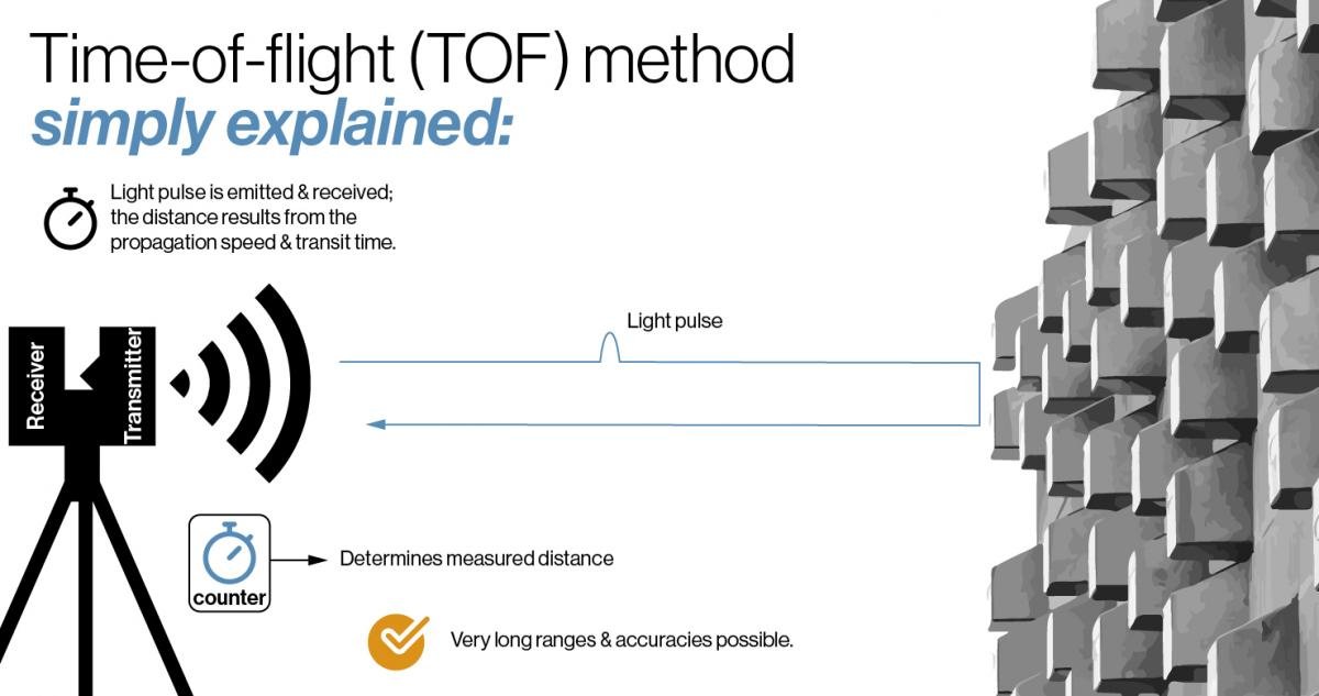
- The scanner calculates the time-of-flight (how long it takes the laser to return to the scanner) and uses this data to determine the distance between the scanner and the object or surface.
- The scanner is moved to several locations, allowing it to capture data from different angles. It uses GNSS positioning to determine its precise location by simultaneously measuring distances to at least four satellites.
- Using this data, consisting of potentially millions of data points, the scanner’s software creates a complete 3D point cloud of the environment.
Using a terrestrial laser scanner is like taking millions of measurements per second and using the data to create a digital twin. The digital model can then be used to detect problems and conflicts and to help with project design.
Terrestrial Laser Scanning Technology Explained
TLS systems use three main scanning technologies: time-of-flight, phase-based, and SLAM (Simultaneous Localization and Mapping)-based (for mobile systems).
A time-of-flight scanner uses an illumination unit that emits a laser pulse, which reflects off each surface and returns to the scanner. The scanner’s sensor or receiver then captures the returning light, and the software calculates the time it took for the pulse to be sent and received, determining the distance from the scanner to the surface based on the speed of light. These scanners are often used for long-range scanning (over one kilometer), have slower scan speeds than other technologies, and may include HDR imaging, which requires a separate post-scan process.
Phase-based scanners determine distances based on the shift in the light wave’s phase using modulated laser beams. These scanners are significantly faster than time-of-flight scanners but have a shorter range (typically 100 to 300 meters). They work quickly and include faster HDR imaging than time-of-flight models.
Mobile systems use SLAM-based scanning, which is designed for indoor use or complex sites. SLAM scanners combine LiDAR with movement sensors to map environments. This enables them to collect data as the operator moves through a space, creating detailed 3D point clouds with an accuracy of 1-5 cm. They are the fastest of the three scanners but often include lower-resolution cameras.
All terrestrial scanners, no matter how they work, collect data points from reflected light. These data points are collected to create a point cloud that software can use to generate a 3D digital model of the space. When paired with HDR imagery, features like color and finish can be added to the model. In the construction industry, these models are used by BIM (Building Information Modeling) software to record existing structures and features, or to document as-built conditions.
Factors in Selecting Terrestrial Laser Scanning Equipment
There are many factors to consider when selecting the best terrestrial laser scanning equipment for surveying or general applications:
- Accuracy and resolution – The level of accuracy is determined by the number of laser pulses that are sent out to create the point cloud. The higher the number of pulses, the greater the scan accuracy.
- Scan range – Both long-range and short-range scanners are available, depending on the nature of the environments you will be scanning.
- Portability – affected by the weight and size of the scanning equipment and whether it’s designed for stationary or mobile operation.
- Speed of capture – Fast scanners can help increase efficiency on fast-paced projects. Note that higher scan resolution takes more time to process and produces larger data files.
- Software compatibility (CAD, BIM, GIS) – Different applications require translating model data into specific software formats, such as CAD, BIM, or GIS.
- Data processing workflow – SLAM-based scanners can process data on-site, whereas other technologies require cloud-based software to create the model.
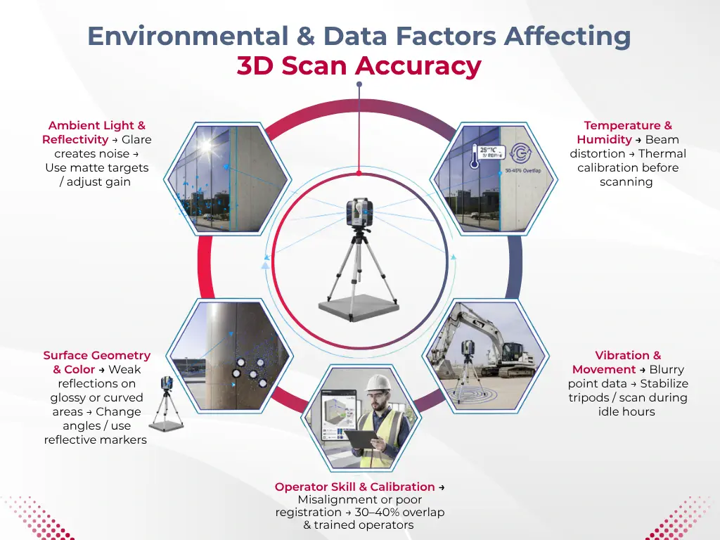
- Environmental performance – Some environments may require more durable scanners that offer protection against elements such as dust and water.
- Price vs application – Scanner prices vary greatly, so it’s important to determine your specific application requirements before purchasing.
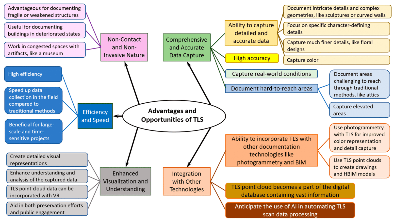
Advantages & Disadvantages of Terrestrial Laser Scanning Equipment
TLS systems offer many advantages, including:
- Extremely accurate measurements – As little as 1 mm of error per 20 meters.
- Rapid data collection – Full 360-degree scans in less than a minute.
- Reduced manual labor – Less time spent making manual measurements and setting up equipment.
- Safe – Measurements taken without entering hazardous areas.
- Works in complex environments – Ability to measure complex surfaces and terrain.
There are some disadvantages to using TLS equipment:
- High initial cost – TLS scanners cost more than other technologies.
- Large data files – With high resolution and accuracy comes larger data files.
- Requires processing software – Secondary software is necessary to translate data points into a usable model.
- Training required – Scanner operators and software users must be trained in best practices and in operating the scanning equipment.
Applications for Terrestrial Laser Scanning
Terrestrial laser scanning can be used in a variety of applications:
- Construction & BIM – Create 3D models of existing buildings or document as-built conditions after project completion.
- Surveying & mapping – Quickly create detailed models showing terrain and land features with accurate geolocation.
- Infrastructure inspection – Detect anomalies that human inspectors may miss.
- Mining – Conduct geological mapping, structure monitoring, and volume calculations.
- Oil & gas facilities – Perform topography mapping, structural integrity assessments, and remote scanning of hazardous facilities.
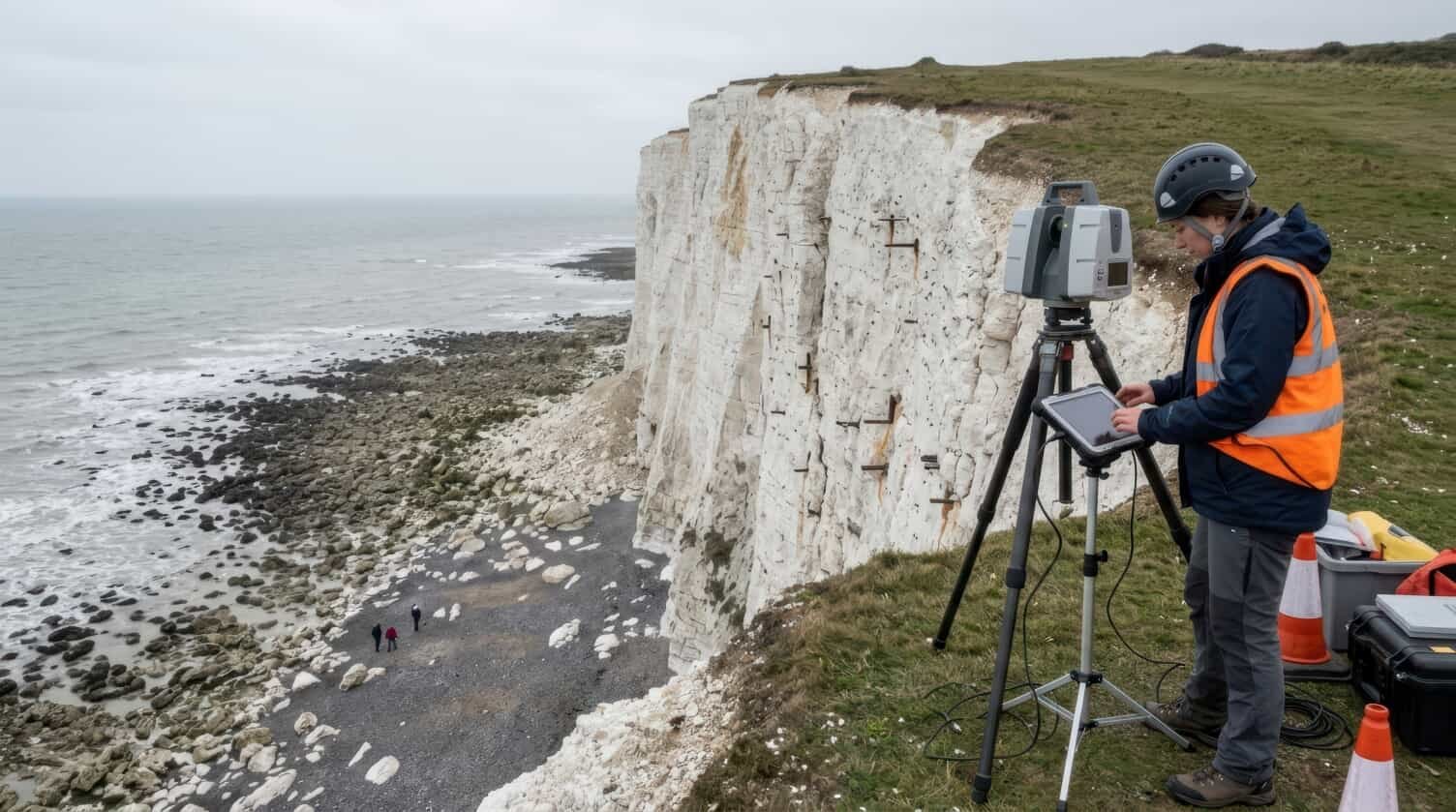
- Heritage preservation – Help preserve historical structures, create 3D tours, and monitor structural stability.
- Forensics – Accurately capture rooms or spaces, including every detail.
Top 10: Terrestrial Laser Scanning Equipment (2026)
These systems represent the most trusted terrestrial laser scanners used by professionals worldwide.
1. Trimble X12
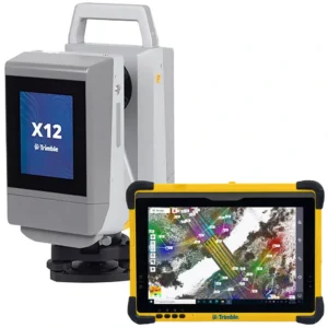
The Trimble X12 3D laser scanning system offers high-speed scanning and an advanced HDR imaging system to help with visual inspections and data sharing. It delivers 2.18 million laser points per second, has a range of 365 meters, and can complete a full-dome scan in as little as 23 seconds.
Best for: Large-scale construction and surveying applications
2. Trimble X9
The Trimble X9 is versatile, lightweight, and efficient. It offers a fast scan speed (under 6 minutes) and a range of 0.6 to 150 meters. The system automatically calibrates and levels itself, allowing you to get right to work without much setup time. It’s perfect for daily field work.
Best for: Surveyors and contractors
3. FARO Focus S70
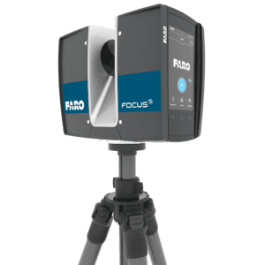
The FARO Focus S70 is a compact and portable scanner designed for ultra-high accuracy, even in extreme conditions. It’s designed to sustain rain, dust, fog, and extreme temperatures. It is also certified with Ingress Protection (IP) Class 54. With its protection rating and high precision imaging, it’s ideal for indoor scanning.
Best for: Architecture and engineering
4. Artec Ray II
The Artec Ray II system is designed for long-range scanning of large objects, such as airplanes, bridges, or archeological sites. It boasts high accuracy for large objects (1.9 mm from 10 meters) and high scan speed (1 min 42 sec at the highest resolution). It also has strong 3D modeling capabilities and easily exports data directly to CAD software.
Best for: Industrial and heritage projects
5. Carlson Scan2K
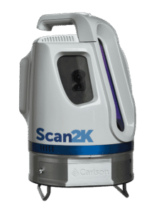
The Carlson Scan2K is a cost-effective long-range LiDAR scanner system. Its long-distance capabilities and fast data-collection speed make it one of the most versatile laser scanners on the market. It has a scanning range of up to 2,000 meters and can capture more than 500,000 data points per second. It easily integrates with Carlson software and includes integrated GNSS, compass, and inclinometer sensors.
Best for: Surveying firms and small teams
6. Leica RTC360
The Leica RTC360 is an economical and portable solution with advanced HDR imaging capabilities. It offers a one-million-point density, capturing data in less than 2 minutes.
7. Leica BLK360 G2
The Leica BLK360 G2 offers high-quality HDR imaging and ultra-fast scanning (20 seconds for a spherical image) in a compact unit. A free companion app is included to adjust scanner controls and view captured data immediately.
8. Trimble SX12

The Trimble SX12 scanning station combines laser scanning, imaging, and surveying into a compact unit. Scanning times average 6 minutes and can be performed at distances up to 200 meters.
9. GeoMax Zoom3D
The GeoMax Zoom3D Scanner provides quality data for both indoor and outdoor scans. It features automatic leveling and target recognition technology that centers on and follows the target, specifically for use on small construction sites.
10. RIEGL VZ-400i
The RIEGL VZ-400i is a high-performance 3D laser scanner designed for a variety of applications. It provides high-quality, fast scans (up to 500,000 points per second), with a range of up to 800 meters.
Comparison Table: Top TLS Equipment
|
Trimble X12 |
Trimble X9 |
FARO Focus S70 |
Artec Ray II |
Carlson Scan 2K |
|
|
Range |
365 meters |
150 meters |
70 meters |
130 meters |
2,000 meters |
|
Accuracy |
High (2.2 mm at 20 m) |
Medium-high (3 mm at 20 m) |
High (+/- 1 mm range error) |
Metrology grade (1.9 mm at 10 m) |
Survey grade (5 mm at 100 m) |
|
Speed |
Up to 2.187 million pts/sec |
Up to 1.0 million pts/sec |
976,000 pts/sec |
Up to 2 million pts/sec |
50,000 to 500,000 pts/sec |
|
Best Use |
Complex, large projects |
General construction |
Indoor architectural, confined spaces |
Large objects, forensics, QA/QC |
Mining, large-scale terrain |
Who Should Use Terrestrial Laser Scanners?
Terrestrial laser scanners are an integral part of a variety of occupations, including:
- Surveyors – document elevations, terrain, and structure locations
- Civil engineers – capture topography and land features
- Construction firms – document existing and as-built conditions
- GIS professionals – accurately map location and terrain
- Government agencies – document terrain, topography, and building assets
Why Buy Terrestrial Laser Scanning Equipment from Kleinschmidt Surveying
Kleinschmidt Surveying has more than 25 years of experience selling TLS and other surveying equipment. We feature trusted brands and provide excellent customer service and technical support after your purchase. Our prices are competitive, and we offer global delivery options. For immediate service, contact our sales team to request a quote or speak with an expert.
FAQs
What is terrestrial laser scanning used for?
TLS is used for a variety of applications, including construction, surveying, archeology, forensics, and mining.
How accurate is TLS?
TLS equipment can achieve an accuracy of up to 2 mm at 20 meters.
What is the difference between LiDAR and TLS?
LiDAR (light detection and ranging) is a technology used to scan large areas. It can be used in stationary and mobile applications, such as drones or vehicles. TLS (terrestrial laser scanning) is one application of LiDAR, in which the scanner is usually mounted on a static tripod.
How much does a laser scanner cost?
Entry-level scanners like Artec generally cost $5,000 to $25,000, while more professional units can cost $30,000 to $90,000 or more.
Which TLS is best for construction?
TLS systems from Trimble, Leica, or Faro are generally considered effective for construction projects. Specific model selection is based on the required accuracy, range, and scanning speed.
For expert assistance in selecting the best TLS system for your application, contact the expert sales staff at Kleinschmidt Surveying.


Comments (97)
Comments are closed.