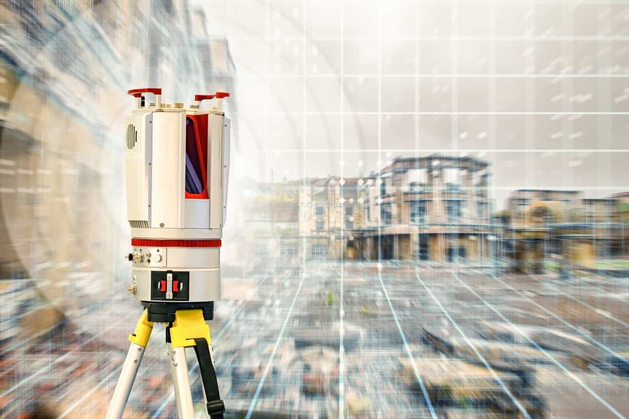
Choosing a 3D laser scanner is a significant investment for any surveying business. With several professional systems available, finding the right equipment means looking beyond advertised scan speeds and maximum measurement ranges. Accuracy, project requirements, field conditions, software compatibility, and total ownership costs all factor into the decision.
Some scanners are designed for detailed building documentation and construction verification, while others excel at capturing expansive outdoor environments and complex industrial structures. The best option depends on what you need to measure and how you plan to use the resulting data.
To help narrow your search, we’ll compare four professional 3D laser scanners: the Trimble X9, FARO Focus Premium, Leica RTC360, and RIEGL VZ-400i. We’ll examine their specifications, field workflows, software requirements, limitations, and equipment costs so you can make a more informed purchasing decision.
How We Compared These Surveying Scanners
This comparison considers four established terrestrial laser scanning systems based on their published manufacturer specifications, documented capabilities, available equipment listings, and intended applications.
The evaluation focuses on seven purchasing considerations:
- Accuracy: Published ranging and 3D point accuracy specifications, including measurement distances and testing conditions.
- Field productivity: Scan speed, setup requirements, imaging, and automated features.
- Registration: Available targetless, automated, and control-based registration workflows.
- Software: Compatibility with established surveying, CAD, BIM, and point-cloud processing tools.
- Portability: Instrument weight, power requirements, environmental protection, and field logistics.
- Support: Manufacturer resources, training, accessories, and equipment servicing.
- Cost: Public equipment listings, licensing considerations, and additional ownership expenses.
Manufacturer specifications are not interchangeable measurements. Accuracy figures can be based on different reflectivity levels, distances, confidence intervals, and test procedures.
This is a specifications-based comparison, not a controlled field test. Buyers should request demonstrations and sample datasets before making a final purchasing decision.
3D Laser Scanner Models Compared
1. Trimble X9: Features, Workflow, and Ownership Costs
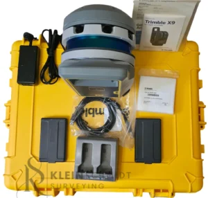
The Trimble X9 is a versatile terrestrial laser scanner designed for surveying, construction, infrastructure, mining, and other reality-capture applications.
The X9 is available in Core LT, Core, and Premium configurations, allowing buyers to select a system based on their required scanning range and performance.
The Premium configuration offers a maximum scan range of 150 meters and a scan speed of up to 1 million points per second. Trimble publishes a 3D point accuracy of 3 mm at 20 meters and range noise below 1.5 mm at 30 meters on an 80% reflectivity target.
One of the X9’s standout features is its automated calibration and self-leveling. These capabilities simplify setup and help maintain consistent instrument performance. Its three calibrated 10-megapixel cameras also provide imagery alongside the point cloud.
The Trimble Perspective software supports field scanning, registration, and real-time visualization. For office processing, users can work with Trimble Business Center or Trimble RealWorks, depending on their deliverables.
Strengths:
- Multiple configurations for different project requirements.
- Automated calibration and self-leveling.
- Integrated imaging.
- Streamlined field registration and quality checks.
- IP55 environmental protection.
Limitations: The 150-meter maximum range may be restrictive for some extensive outdoor applications. Buyers should also account for software licensing and the computing resources needed to process larger datasets.
A publicly listed X9 system was priced at approximately $54,999. Actual pricing depends on configuration, accessories, licensing, and dealer quotations.
2. FARO Focus Premium: Features, Workflow, and Ownership Costs
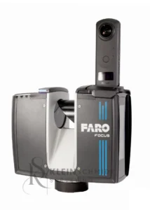
The FARO Focus Premium is designed for professionals who need detailed reality capture for architecture, engineering, construction, and existing-condition documentation.
The Focus Premium family includes different range configurations. Published specifications for the Premium 350 include a maximum range of 350 meters on targets with 90% reflectivity, up to 2 million points per second, and 3D accuracy of 2 mm at 10 meters and 3.5 mm at 25 meters.
FARO’s newer product information describes the Focus Premium as supporting coverage up to 200 meters. Because product generations and configurations differ, buyers should verify the exact instrument and specification sheet before comparing range figures.
The scanner supports high-resolution color imaging and HDR capture. FARO Stream provides field control and visualization, while FARO SCENE supports point-cloud processing and registration. Sphere XG provides cloud-based collaboration and data access.
Strengths:
- Multiple range configurations.
- High-speed scanning.
- Detailed color imaging.
- Established point-cloud processing workflows.
- Applications ranging from building documentation to construction verification.
Limitations: The maximum advertised range depends on the exact configuration and target reflectivity. Software requirements and licensing should also be reviewed when budgeting for the complete system.
A publicly listed FARO Focus Premium 350 was approximately $42,769. This is a listed retail price, not a guaranteed quotation for every configuration.
3. Leica RTC360: Features, Workflow, and Ownership Costs
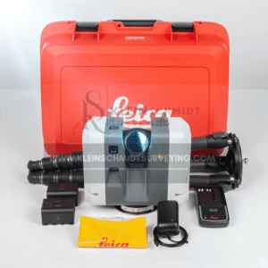
The Leica RTC360 is a high-speed terrestrial laser scanner particularly suited to building documentation, construction, and detailed indoor surveys.
It captures up to 2 million points per second and has a published measurement range of 0.5 to 130 meters. Its 3D point accuracy is 1.9 mm at 10 meters, 2.9 mm at 20 meters, and 5.3 mm at 40 meters under the manufacturer’s stated test conditions.
One of its most useful features is the Visual Inertial System (VIS). By tracking scanner movement between setups, VIS helps automatically align scans during field collection. This can reduce the time spent manually registering individual scan positions.
The RTC360 also includes a three-camera imaging system that produces calibrated spherical imagery. Its Double Scan feature can identify and remove moving objects by comparing two passes.
Leica Cyclone FIELD 360 supports field control, visualization, and registration workflows. Additional processing can be completed using Leica Cyclone software.
Strengths:
- Fast scanning at up to 2 million points per second.
- Integrated visual-inertial registration.
- High-resolution HDR imagery.
- Automatic moving-object filtering.
- Compact design for a professional terrestrial scanner.
Limitations: Its 130-meter maximum range is shorter than some competing long-range systems. Buyers should also consider the Leica software ecosystem and the additional licensing requirements for their intended deliverables.
A publicly listed Leica RTC360 was approximately $32,499. Additional accessories, including a carbon tripod and transport equipment, may increase the purchase price.
4. RIEGL VZ-400i: Features, Workflow, and Ownership Costs
The RIEGL VZ-400i is designed for demanding long-range scanning applications, including infrastructure, industrial facilities, mining, and large outdoor environments.
Its maximum measurement range reaches 800 meters under specified conditions using the 100 kHz pulse repetition rate and highly reflective targets. Maximum range decreases as pulse repetition rate increases or target reflectivity decreases.
The instrument supports measurement rates of up to 500,000 measurements per second, with published ranging accuracy of 5 mm and ranging precision of 3 mm. Its 3D position accuracy is specified at 3 mm at 50 meters and 5 mm at 100 meters under RIEGL’s test conditions.
The scanner uses waveform processing technology and supports multiple-target measurements. It also offers integrated GNSS and orientation sensors, simultaneous image and scan acquisition, and automatic onboard registration.
RIEGL’s RiSCAN PRO software provides tools to manage, register, analyze, and export scan data.
Strengths:
- Exceptional long-range measurement capabilities.
- Advanced waveform processing.
- Multiple-target capability.
- Integrated positioning and orientation sensors.
- Automatic onboard registration.
- Designed for demanding outdoor and industrial applications.
Limitations: The VZ-400i is heavier than the other scanners in this comparison, weighing approximately 9.7 kg. Its specialized capabilities may also be unnecessary for routine building surveys or smaller construction projects.
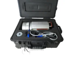
Kleinschmidt Surveying has publicly listed a RIEGL VZ-400i for $8,000. However, buyers should confirm whether the instrument is new, used, or refurbished, along with its service history, software licenses, and included accessories. This listing should not be treated as a verified price for a new VZ-400i system.
Which Scanner Fits Your Surveying Applications?
Building Surveys and As-Built Documentation
Building surveys require detailed information about existing conditions, including walls, ceilings, structural elements, and architectural features.
The Leica RTC360 and Trimble X9 are particularly relevant for these projects. Both offer integrated imaging and field workflows that support efficient indoor data collection.
The FARO Focus Premium is another strong consideration for architectural documentation and as-built capture.
When evaluating scanners for building surveys, consider their performance in confined spaces, imaging capabilities, registration workflows, and compatibility with the software used to produce CAD drawings or BIM models.
Construction Verification and BIM Workflows
Construction verification often involves comparing existing conditions against design information. Repeat scanning, reliable control, and consistent registration are essential.
The Trimble X9 offers field registration and integration with Trimble Business Center and RealWorks. The FARO Focus Premium also supports construction verification and as-built documentation.
The Leica RTC360’s VIS technology can help streamline repeated scan setups, while its imagery provides useful visual context.
Before purchasing, confirm that your scanner’s point-cloud outputs are compatible with the BIM and CAD platforms required by your clients.
Topographic and Larger Outdoor Projects
Large outdoor projects introduce different challenges, including longer measurement distances, changing surface conditions, and limited access to certain locations.
The RIEGL VZ-400i is particularly suited to these applications because of its long measurement range and advanced waveform processing.
The FARO Focus Premium and Trimble X9 can also support outdoor reality capture, depending on the required coverage and accuracy.
Remember that maximum range does not guarantee reliable measurements across every surface. Vegetation, atmospheric conditions, target reflectivity, and the angle of incidence all affect measurement performance.
Industrial Facilities and Complex Structures
Industrial facilities often contain equipment, piping, structural steel, and other features that create measurement challenges.
The Leica RTC360 and FARO Focus Premium can be useful for detailed facility documentation. The RIEGL VZ-400i may be a better fit for larger or more demanding industrial environments.
Consider instrument portability, access restrictions, occlusions, and the level of detail required in the final documentation.
Features That Matter When Comparing 3D Laser Scanners
Accuracy, Precision, and Registration Quality
Accuracy describes how close a measurement is to its true value. Precision describes how consistently an instrument repeats a measurement. Registration accuracy is different. It describes how well multiple scans align with one another in a shared coordinate system. A scanner may offer excellent individual measurement accuracy but still produce a poorly aligned project if the registration workflow is inadequate.
Compare specifications at equivalent distances and under similar conditions. Also determine whether your project requires survey control, target-based registration, or a targetless workflow.
Working Range and Site Conditions
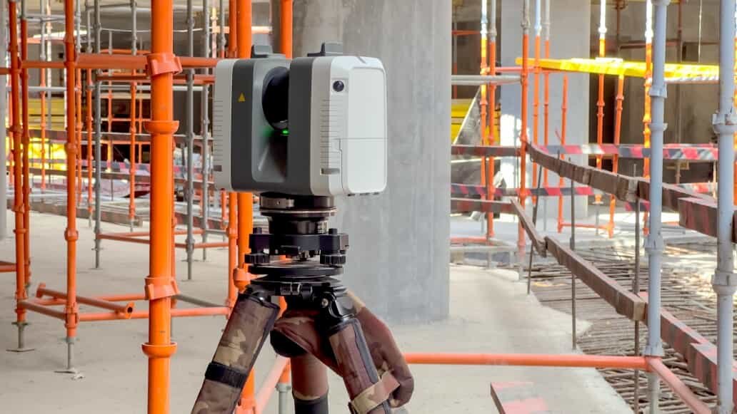
A scanner’s published maximum range is not necessarily its practical working range.
Reflectivity, sunlight, atmospheric visibility, surface geometry, and environmental conditions can all influence performance. For example, RIEGL specifies different maximum ranges for highly reflective and lower-reflectivity natural targets. FARO also publishes different measurement ranges depending on target reflectivity.
Choose a scanner based on the distances and surfaces you encounter regularly, rather than selecting the instrument with the largest advertised number.
Scan Speed Versus Total Project Time
Points per second is only one part of field productivity. A complete scanning project also involves setup, positioning, image capture, registration, quality checks, data transfer, and office processing.
Features such as automatic calibration, visual-inertial tracking, and real-time registration can make a meaningful difference to the overall workflow. Ask manufacturers or dealers to demonstrate the complete field-to-finish process rather than comparing scan speeds alone.
Software, File Formats, and Interoperability
Point clouds are only useful when they can be processed into the deliverables your clients need. Trimble, FARO, Leica, and RIEGL each offer software ecosystems to manage and process captured data.
Before purchasing, confirm support for your required file formats and compatibility with applications such as AutoCAD, Revit, and other CAD or BIM platforms. Also ask whether processing tools are included, require subscriptions, or involve additional licensing fees.
Portability, Batteries, and Field Support
Consider the instrument’s weight, battery life, operating temperature, environmental protection, and transportation requirements.
The Leica RTC360 weighs approximately 5.35 kg without batteries, while the RIEGL VZ-400i weighs approximately 9.7 kg. These differences can affect how easily equipment moves between setups, particularly on large or difficult-to-access sites. Reliable technical support, replacement batteries, accessories, and training are also important parts of a long-term equipment investment.
How Much Does a Surveying 3D Laser Scanner Cost?
Equipment Purchase Price
Professional terrestrial laser scanners represent a substantial investment, and prices vary depending on configuration, condition, and included equipment.
Public listings reviewed for this comparison include:
- Leica RTC360: approximately $32,499.
- FARO Focus Premium 350: approximately $42,769.
- Trimble X9: approximately $54,999.
- RIEGL VZ-400i: $8,000, listed by Kleinschmidt Surveying; condition and configuration require confirmation.
These prices are reference points, not directly comparable package quotations. Some listings may represent different equipment conditions or configurations.
For an accurate comparison, request an itemized quotation for the exact scanner model and configuration you intend to purchase.
Software and Licensing Costs
Software can represent a significant portion of the total investment.
Depending on the manufacturer, buyers may need licenses for field control, registration, point-cloud processing, CAD integration, or cloud collaboration.
For example, Trimble offers Perspective for field workflows and RealWorks or Business Center for office processing. FARO provides SCENE and other software options, while Leica offers Cyclone products and RIEGL provides RiSCAN PRO.
Ask whether licenses are perpetual or subscription-based, whether updates are included, and whether licenses can be transferred if equipment changes ownership.
Accessories, Training, and Maintenance
Additional expenses may include:
- Surveying tripods and mounting equipment.
- Batteries, chargers, and power supplies.
- Targets and reference accessories.
- Rugged tablets or field computers.
- Workstations for processing large point clouds.
- Training and technical support.
- Calibration, servicing, and repairs.
Even seemingly small accessories can increase the final purchase price.
Example Total Ownership Budget
Consider a Leica RTC360 purchase using publicly listed equipment prices.
Item Published Price Leica RTC360 scanner $32,499 GST80 carbon tripod $2,900 GVP736 transport backpack $525 Published-price subtotal $35,924
This is an illustrative equipment subtotal, not a complete ownership budget. It excludes any additional software, computing hardware, training, maintenance, taxes, shipping, and other accessories not included in the selected listings.
For a more accurate budget, request a complete package quotation and separate initial purchase expenses from recurring costs.
New vs. Used 3D Laser Scanners: What Should You Check?
A used scanner can provide access to professional equipment at a lower purchase price, but buyers should carefully evaluate its condition.
Before purchasing, ask for:
- Instrument condition and complete service history.
- Current calibration or verification documentation, where available.
- Software license ownership and transferability.
- Confirmation of included batteries, chargers, tripods, and accessories.
- Warranty coverage and return terms.
- Availability of replacement parts and manufacturer support.
- Demonstration scans or sample datasets.
A demonstration is especially valuable because it allows you to evaluate data quality and workflow compatibility before committing to a purchase.
The lowest purchase price does not necessarily represent the best long-term value. An instrument with limited support, outdated software, or unavailable replacement parts may cost more to maintain over time.
Do You Need a Laser Scanner, Total Station, or GNSS System?
These instruments serve different surveying purposes.
A terrestrial laser scanner captures dense point clouds representing the surrounding environment. It is particularly useful for detailed existing-condition documentation, complex structures, and as-built surveys.
A total station measures precise angles and distances to individual points. It is often better suited to establishing control, setting out construction features, and collecting specific measurements.
GNSS systems use satellite positioning to determine coordinates and are especially useful for control networks and outdoor surveying where satellite visibility is available.
Many projects benefit from combining these technologies. A surveyor might establish control using GNSS or a total station, capture detailed site information with a laser scanner, and register the point cloud to the project coordinate system.
A dense point cloud does not automatically replace survey control or satisfy every measurement requirement. Select equipment based on the actual deliverables and accuracy standards your project demands.
Questions to Ask Before Buying a 3D Laser Scanner
Before investing in a new scanning system, take time to evaluate your requirements.
Consider these questions:
- What accuracy must the final deliverable achieve?
- What measurement distances and site conditions will the scanner encounter?
- Which software and file formats do clients require?
- What accessories, licenses, and services are included in the quoted price?
- Can the dealer provide a relevant demonstration or sample dataset?
- What training, warranty, maintenance, and technical support are available?
Answering these questions can help eliminate unsuitable options and make equipment comparisons much more straightforward.
Frequently Asked Questions
What Is the Best 3D Laser Scanner for Land Surveying?
The best scanner depends on your projects’ size, complexity, and accuracy requirements. The Trimble X9 and FARO Focus Premium offer versatile reality-capture workflows, while the RIEGL VZ-400i is particularly suited to long-range outdoor applications. The Leica RTC360 is a strong option for detailed building and construction documentation.
How Much Does a Professional Surveying Laser Scanner Cost?
Professional scanners can cost tens of thousands of dollars, depending on the model, configuration, software, and accessories. Used equipment may be available for less, but buyers should verify its condition, licensing, and service history before purchasing.
How Accurate Are Terrestrial Laser Scanners?
Accuracy varies by instrument and measurement conditions. Professional systems publish different ranging and 3D point accuracy specifications, often measured at specific distances and reflectivity levels. Always compare the manufacturer’s stated metrics rather than relying on a single advertised accuracy number.
What Is the Difference Between Scanner Accuracy and Registration Accuracy?
Scanner accuracy describes the quality of individual measurements, while registration accuracy describes how well multiple scans align in a shared coordinate system. Both contribute to the quality of the final point cloud.
Is a Used 3D Laser Scanner a Good Investment?
A used scanner can be a worthwhile investment if it has been properly maintained and includes transferable software licenses, available accessories, and adequate support. Always request service documentation and a demonstration before purchasing.
Can a 3D Laser Scanner Replace a Total Station?
Not entirely. Laser scanners capture dense spatial information, while total stations provide precise measurements of individual points and support surveying control and construction layout. Many professional workflows use both technologies.
Which Software Do I Need to Process Scan Data?
The right software depends on your scanner and final deliverables. Options include Trimble RealWorks, Trimble Business Center, FARO SCENE, Leica Cyclone, and RIEGL RiSCAN PRO. Check file compatibility and licensing requirements before selecting an instrument.
Find a Scanner That Matches Your Project
Investing in a 3D laser scanner means choosing equipment that supports your surveying workflow today while providing room for future projects. Range, accuracy, registration, software compatibility, portability, and total ownership costs all deserve consideration.
Whether you’re documenting buildings, verifying construction progress, surveying large outdoor environments, or capturing complex industrial facilities, the right equipment can help you collect more useful data and work more efficiently.
At Kleinschmidt Surveying, we offer surveying equipment to support professionals across a range of applications. Explore our 3D laser scanner selection to see available options.
Have questions about which scanner is right for your work? Share your project type, accuracy requirements, preferred software, and budget with our team. We can help you narrow down the options and find equipment that fits your surveying needs.
 English
 Spanish
 French
 German
 Dutch